
Architects but not at any price
Rather as with Darwin and Wallace, it seems geography is having a moment of, if not simultaneous invention , at least converged thinking. There was I in a meeting literally yesterday consigning map layering to a tired paradigm, positioning the map instead as the output artifact of analysis relevant to the matter in hand… and today reading Ed's piece on geographers as architects.
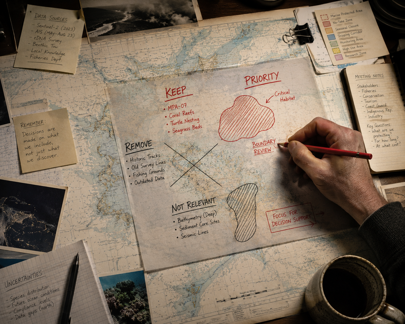
Geographer - editor of evidence, creating the frame through which reality becomes actionable? (ChatGPT image)
Sadly, for the first time in many years I wasn't able to make GeoBusiness this year, so couldn't engage first hand — and equally missed witnessing the continuing rise of what Ed and I would have called, and perhaps still do, "remote sensing" across both location intelligence and GeoAI. I've written on this on my own blog (not least about the baseline problem) and as co-editor of AGI's Future Trends report, where trust, governance and accountability featured prominently as talking points.
Anyway, back to the matter at hand. Cartographers have always made choices about the balance between signal and noise, be it in the choice of projection or the features immortalised by their points, lines and polygons. In that sense, and to the will of their paymasters political or otherwise, cartographers have always been architects of worlds. And lest we forget, there remain two societies of cartographers in the UK alone, distinct from AGI, RGS and RICS, a breed apart, and ones whose rules and rigour have often been sidelined in the digital age.
As argued in the Future Trends report, and borrowing a phrase from William Priest, first head of the Geospatial Commission: "geographers are having a moment." Our value in helping make sense of a 4D world has never been higher. It is here and in the structural weaknesses (for now) of LEMs and world models that our capabilities as analysts, framers, filterers, and decision influencers come to the fore. Ed is bang on about that.
But being architects means being present at the foundations, not just the fit-out. Geographers cannot but be critical to the creation of the models that underpin decisions, assessing baseline and dynamic data against the asks to be made of the model, and the relationships therein. That means being in the room when the ontology is set, not handed the brief afterwards. And we must certainly be in the loop to help define what ultimate decision content actually looks like, which is where Ed's final point, compelling as it is, deserves a degree of scrutiny. Defining the spatial reasoning that powers a decision is only half the job if we're not also interrogating whose decision, in whose interest, and on whose data.
Where we need to be careful is in how those decision layers are framed. Content has always been political, presented to generate support for a new idea, peddle a particular vision, or illustrate a specific decision point. Clutter is not the cartographer's friend, let alone their client's. But what is extraneous to some can be collateral damage, intended or otherwise, to others. Our role in these ever richer data environments is to help both cartographer and client see the map for what it is: a selective, curated output of a diverse and potentially dynamic environment, subject to and impacting on people, places and processes beyond the printout or screen. And to enable both parties to ask location-intelligent questions about the presence and absence of decision-relevant information.
As geographers, that is our superpower and our value, not being relegated to the enabling gopher for some higher or lower idea or ideal.